Error: Contact form not found.
Google Rating


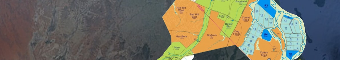
Maps are an essential tool in the efficient running of any property
Enquire NowShowcase your property and take your property map to the next level with our Moving Property Maps. Moving Property Maps help visitors to easily navigate and understand their surroundings. Even when out of range, the devices’ GPS locator still displays exact positioning, make your property easy to visualise, simple to navigate, and highly memorable with Moving Property Maps.
Real Estate Maps
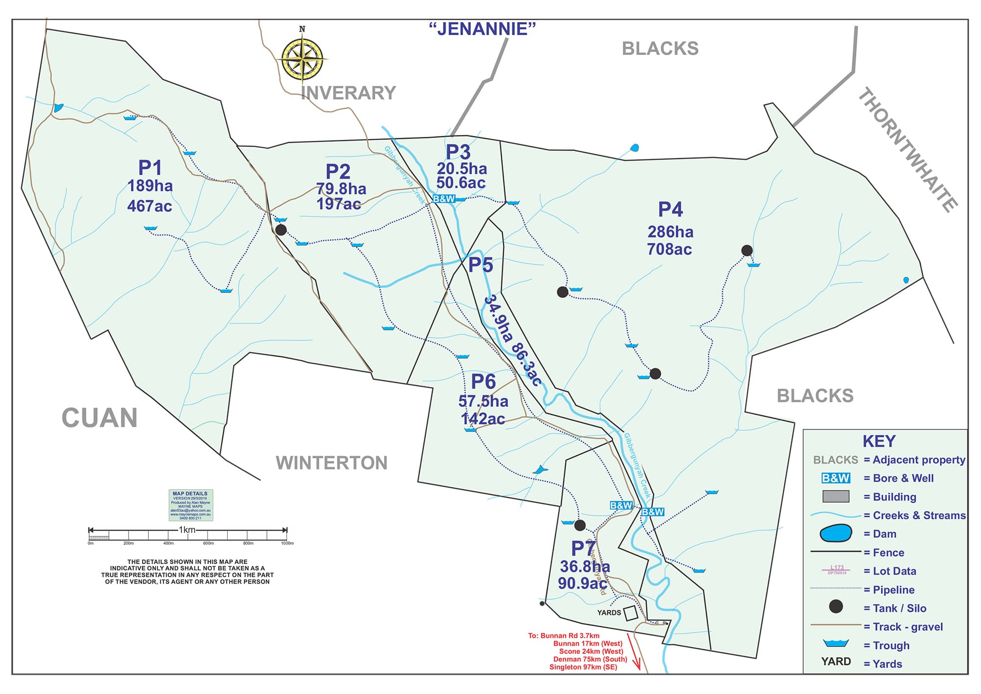
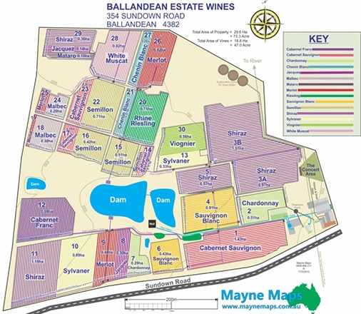
Selling a property can be made easy using a map that showcases everything the property has to offer.
Maps can maximise the selling price which can recover the small cost of the map many times over.
Also, maps can minimise the selling time and this makes the map every more valuable.
Gallery of Maps
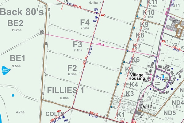
A small portion of a horse stud.
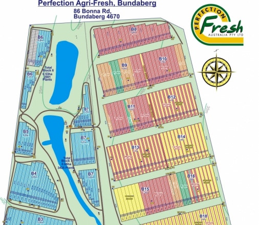
Here is a quick view of a sample of maps produced by Mayne Maps.
Download
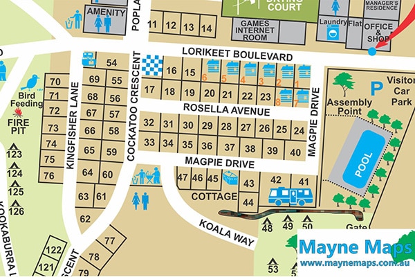
Part of a caravan park.
Here you can download many samples of maps in a pdf format.
Why choose Us
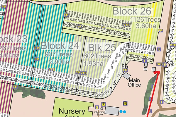
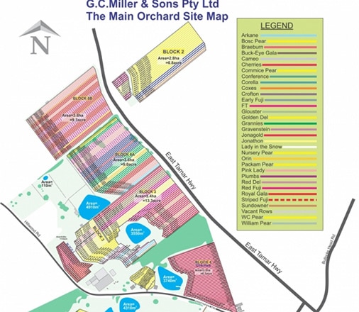
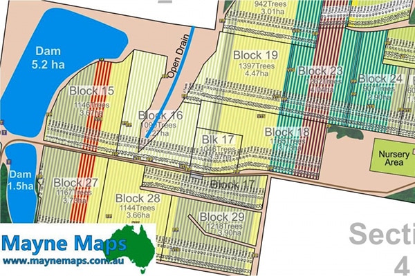
Part of a macadamia farm. Each row has the row number as well as the number and variety of trees.
Property Mapping and Farm Mapping Services
From horse studs, cattle properties, and sheep stations to orange orchards, small crop farms, wineries, tourist maps, and more, Mayne Maps have 15 years’ experience in producing maps for commercial projects of all sizes and levels of complexity. Whether you’re a small-scale farm or a robust tourist destination, Mayne Maps ensures the same level of attention to detail, professionalism and quality across all projects. As a small business that is run entirely from home, Mayne Maps pride themselves on being established enough to provide a service that is unrivalled in quality, yet small enough to remain true to old-fashioned customer service. With minimal overhead costs, they happily pass these savings onto their valued clients to ensure you’re receiving the very best service, without being left out of pocket.
Quality
Where quality meets detail, Mayne Maps mapping services are designed as vector graphics to ensure the highest level of clarity and image quality, with the option of switching on and off layers to display varying features, depending on the level of detail required. Boasting professionalism and accuracy, Mayne Maps stand proudly behind the quality of their work, which is why they will happily cancel the project at no cost to you, should you not be 100% satisfied with the way the map is progressing.
-
Why have a map?
So you know the property like the back of your hand!
Why would you spend money on a map?- Maps help you explain to workers and contractors where it is.
- Maps help you record things that happen or what needs to be done on the property.
- Maps aid in planning for the future.
Read More -
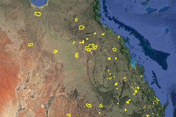
Properties we have Mapped
Just look at all the properties that have been mapped by Mayne Maps!
Some recently purchased properties have requested a map from Alan. He has discovered that he already mapped the property.
Read More -
About Us
Alan became heavily involved in computers over 20 years ago. When he moved to Stanthorpe 15 years ago, he started drawing Property Maps for some of the local growers.
Read More -
My Guarantee to You
Cost
This is impossible to tell and it depends entirely how long the project takes.
I will start the map and send you what I have produced and the cost up to now.
How long it takes is completely out of my control – it is up to you.Read More
Contact Information
Mayne Maps
349 Fig Tree Pocket Rd,
Fig Tree Pocket,
QLD, 4069,
Australia
Phone number: 0409 800 211
Email Address: [email protected]